Flash floods forecast as intense rain to hit south of france
- Select a language for the TTS:
- UK English Female
- UK English Male
- US English Female
- US English Male
- Australian Female
- Australian Male
- Language selected: (auto detect) - EN
Play all audios:

THE WEATHER PHENOMENA IS KNOWN AS AN ÉPISODE CÉVENOL OR MÉDITERRANÉEN AND HAPPENS AROUND FOUR TIMES A YEAR Southern France is set to experience intense rainfall – and flash flooding – this
week, with storms hitting the area hard. A weather phenomena known as the _cévenol_, where warm Mediterranean air collides with the Cévennes mountains, will cause storms and heavy rainfall.
Although there will be some rain today (October 16) and on Tuesday in the area south of the Cévennes mountains, it will increase greatly on Tuesday evening, hitting the Languedoc in
particular. For the rest of the week, up until at least Friday evening, rainfall across all of the Mediterranean coast and southern Massif Central mountains will be heavy and continuous. In
some areas, in particular the Cévennes, over 250 mm of rain is predicted to fall between today and the end of the week. WHAT WEATHER IS EXPECTED AND WHERE? The bad weather will begin to
start in earnest around the Cévennes mountain range on Tuesday evening (north-west of Nîmes), although there will be showers along the western Mediterranean coastline Tuesday afternoon.
Heavy rainfall will start to fall in this mountainous region mostly in the Ardèche department – as well as in the Hérault and Gard departments – which could last until the end of the week.
At the same time, _Météo France _has warned of a “rainy episode” in the south-east likely to produce storms between Tuesday October 17 and Thursday October 19. Var, Alpes Maritimes, Bouches
du Rhône and Alpes de Haute Provence will be affected. On Thursday evening, storms will start in the south-east, along the border with Italy, and last into Friday evening. Cumulative
rainfall for the week is also set to be around 250mm in the area surrounding Nice. This is the equivalent of around 250 litres per m² of rainfall in a matter of two or three days. The
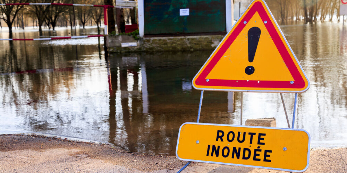
suddenness and intensity of the rainfall during these autumn _cévenol_ storms are dangerous and can cause flash floods and catch people outside – including drivers – unaware. Residents
should regularly check if _Météo France _has issued warnings on its website. Warnings are only given up to the following day (for example on a Monday you can only see warnings up to Tuesday
night), so you are recommended to check the site each day. The website is updated at least twice per day, in the early morning and around 16:00. READ MORE: WHAT TO DO (AND NOT DO) DURING
HEAVY RAIN AND FLOOD ALERTS IN FRANCE By the weekend, the worst of the weather will be over but some rainfall may persist in the south and south-east. Elsewhere in France, rainfall is set to
hit most of the country, although not to the same level of severity. WHAT IS CAUSING THE RAINFALL? This particular weather phenomenon is known as the _cévenol_ (or _épisode cévenol_) due to
its appearance largely around the Cévennes mountain range. A rush of warm air from the Mediterranean sea is pushed up to the foothills of the Cévennes, which lie on the south of the Massif
central mountain range. The reaction between this warm sea air and cold air of the mountains causes dense clouds to form, which, blocked from continuing further north by the mountains,
release torrents of rain in lower mountains or the areas directly south along the Mediterranean. Sometimes the phenomenon is called the _épisode méditerranéen_, in particular when it affects
the coastal areas more than the interior, although it is actually the same event. It usually happens around four times a year, and mostly takes place in the autumn. It mostly touches
departments south of the Cévennes and inside the ‘Mediterranean arc’ (Bouches du Rhône, Hérault, Aude, Gard, Ardèche, Lozère, Aveyron), but can also hit those in the far south-east (Alpes
Maritimes, Var, Alpes de Haute Provence, Hautes Alpes). The _cévenol_ is the largest cause of red-alert storm warnings by _Météo France_ due to the intensity of the rainfall and its
relatively quick nature. Rainfall within five days can reach up to almost 1,000 mm (1,000 litres per m²) – the highest recorded was in Loubaresse, Ardèche when 910 mm fell in five days.
However, up to 500 mm can fall within a single day, before storms subside, causing intense flash flooding that overwhelms typical flood defences. In October 2015, a particularly intense
_cévenol_ caused 20 deaths in the Alpes Maritimes and over €600 million worth of damage. READ MORE: FRANCE STORM WARNINGS CONTINUE: TIPS ON HOW TO SECURE YOUR PROPERTY STORMS IN FRANCE: WHAT
TO DO IF AT HOME, OUT WALKING OR IN CAR