Weather alerts are raised a level as storms multiply across france
- Select a language for the TTS:
- UK English Female
- UK English Male
- US English Female
- US English Male
- Australian Female
- Australian Male
- Language selected: (auto detect) - EN
Play all audios:

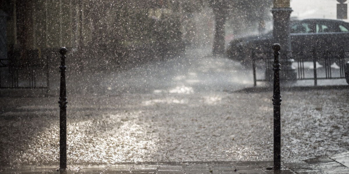
FOUR DEPARTMENTS NOW FACE HEIGHTENED WARNINGS, WITH MOST OF FRANCE ON ALERT FOR A COMBINATION OF STORMS, WINDS AND HEAVY RAINFALL THROUGHOUT THE DAY Forecasters have now placed four
departments in south and east France on a tier-three orange warning for heavy rain and flooding, as storms continue to pelt much of the country. Ain and Isère will join Drôme and Ardèche to
face the warnings this afternoon and they are expected to remain in place overnight until Friday. Most other departments now face tier-two yellow warnings for a combination of storm alerts,
strong winds, and heavy rain with the risk of flooding, both on the western and northern coastlines and across the east of France. By Friday, however, the worst of the stormy weather will be
over, with only a few departments left facing warnings. FRANCE SET FOR HEAVY RAINS The four departments facing heightened warnings will begin to be affected this afternoon (September 21),
when heavy rain starts to fall alongside the stormy conditions. Drôme and Ardèche will face tier-three warnings from 14:00, with Ain and Isère joining around 16:00. Elsewhere, as storms roll
eastwards across France, most departments will see storm and heavy rain warnings throughout the day. This morning, for example, heavy rain and flood warnings are in place across the western
stretches of France and around Paris, but by midnight they are in place on the Belgian border and close to Switzerland. All in all, 70 departments throughout today will face a warning of
some kind. You can find an interactive map showing the warnings on the official _Météo France_WEBSITE. You can see changes by the hour by clicking on a specific weather condition on the
right-hand side (_orages, vent_, etc), and then clicking on the triangular play button underneath the map. By tomorrow (September 22) however, the storms will have mostly disappeared, with
only a handful of departments, along the Atlantic coastline and Swiss border, still expected to be subject to warnings. READ MORE: WHAT TO DO (AND NOT DO) DURING HEAVY RAIN AND FLOOD ALERTS
IN FRANCE STORM BEFORE THE CALM… BEFORE THE WARM The stormy conditions are set to bring a gradual lowering of temperatures. Temperatures will reach their coldest on Saturday when morning
temperatures will be between 6C and 10C and are unlikely to climb above 20C anywhere in the country. However, from next week, they are set to rise again, with average highs of 30C in the
south – and 27C in the north. Early forecasts predict the heat could last into the first days of October. READ MORE: STORMS IN FRANCE: WHAT TO DO IF AT HOME, OUT WALKING OR IN CAR
TEMPERATURES UP TO 32C FORECAST NEXT WEEK FOR SOUTHERN HALF OF FRANCE